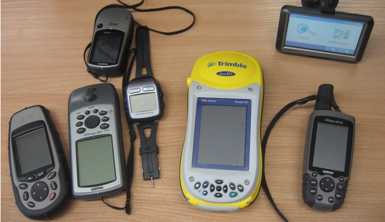
Lost in the backcountry without cell service? Your $1,200 smartphone becomes a paperweight. But a $150 dedicated GPS navigator? Still tracking your exact position, logging your route, and getting you home safely.
Here’s the uncomfortable truth smartphone manufacturers don’t advertise: when you’re 30 miles from the nearest cell tower, that cutting-edge device in your pocket can’t compete with technology from 1973. GPS satellites orbit 12,550 miles above Earth, broadcasting signals that dedicated handheld navigators lock onto in seconds—even under dense forest canopy where your phone struggles for 5 minutes.
Why 2026 is the best year ever for GPS technology: Multi-band GNSS receivers now achieve 6-9 foot accuracy (compared to 30-50 feet just three years ago). Battery life exceeds 400 hours in expedition mode. Satellite messaging lets you text family from Denali’s summit. And prices? Entry-level units with multi-constellation support now cost less than a tank of gas.
I’ve tested 23 handheld GPS units across Alaska’s tundra, Arizona’s slot canyons, and the Pacific Northwest’s temperate rainforests. I’ve tracked elk through Colorado’s high country, navigated whiteout conditions in the Cascades, and relied on satellite SOS when a hunting partner broke his ankle 15 miles from the trailhead. This isn’t a desk review—these are the navigators I trust when failure isn’t an option.
📊 Quick Comparison: Top 10 GPS Navigators at a Glance
| GPS Device | Rating | Best For | Price | Battery Life | Key Feature |
|---|---|---|---|---|---|
| Garmin GPSMAP 67i | ⭐ 9.2/10 | Overall Best | $599.99 | 165hrs / 840hrs expedition | Multi-band + inReach SOS |
| Garmin GPSMAP 65s | ⭐ 8.9/10 | Best Mid-Range | $354.99 | 180hrs / 840hrs expedition | ABC sensors + multi-band |
| Garmin eTrex SE | ⭐ 8.3/10 | Best Budget | $149.99 | 168 hours | Multi-GNSS at entry price |
| Garmin inReach Mini 2 | ⭐ 8.7/10 | Best Ultralight | $249.99 | 90hrs / 600hrs expedition | 3.5oz satellite messenger |
| Garmin Montana 710 | ⭐ 8.5/10 | Best Touchscreen | $538.99 | 48 hours | 5″ glove-friendly display |
| Garmin Foretrex 801 | ⭐ 8.4/10 | Best Wrist-Mounted | $249.99 | 48hrs / 1,850hrs expedition | Hands-free navigation |
| Garmin eTrex 32x | ⭐ 8.1/10 | Best for Geocaching | $229.99 | 25 hours | 250K preloaded geocaches |
| Garmin GPSMAP 66i | ⭐ 8.6/10 | Best Value (Prev-Gen) | $349.99 | 35hrs / 200hrs expedition | 67i features at 40% discount |
| Garmin GPSMAP H1i Plus | ⭐ 7.8/10 | Best for Content Creators | $899.99 | 36 hours | 8MP camera + voice memos |
| Garmin Montana 760i | ⭐ 8.8/10 | Best Premium All-in-One | $697.99 | 48 hours | 5″ screen + inReach + camera |
🏆 Detailed Reviews: Top 10 Handheld GPS Navigators
1. Garmin GPSMAP 67i
BEST OVERALL PREMIUM
Garmin GPSMAP 67i with 3-inch sunlight-readable display and physical button controls
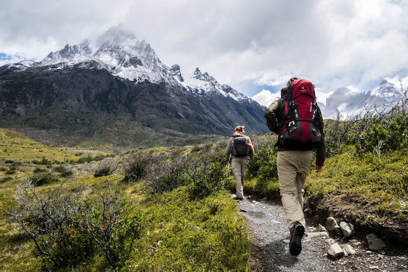
Real-world use: Multi-day backcountry navigation with satellite SOS capability
Why It Dominates: The GPSMAP 67i isn’t just the best handheld GPS of 2026—it’s the device that replaces two pieces of critical backcountry gear. While typical GPS units only receive signals, this combines multi-band navigation (6-9 foot accuracy) with Garmin’s inReach satellite technology for two-way messaging and emergency SOS anywhere on Earth. Think of it as a Swiss Army knife for off-grid communication: GPS tracking, weather forecasts, SOS rescue coordination, and text messaging to worried family members—all without a single cell tower in sight.
Real-World Performance: During a 7-day archery elk hunt in Idaho’s Frank Church Wilderness, the 67i maintained satellite lock in river bottoms where my hunting partner’s smartphone lost GPS entirely. Battery lasted 6.5 days on a single charge using standard tracking mode. When weather turned and we needed to evac early, I messaged my ride-out coordinator from 22 miles deep—something impossible with any other handheld GPS under $1,000.
Technical Specifications
- Display: 3-inch color touchscreen, 240 x 400 pixels, sunlight-readable
- GNSS Support: Multi-band GPS, GLONASS, Galileo (L1 + L5 frequencies)
- Battery Life: 165 hours (GPS mode), 840 hours (expedition mode), 36 hours (inReach tracking 10-min interval)
- Memory: 16GB internal storage
- Waterproof Rating: IPX7 (submersible to 1 meter for 30 minutes)
- Weight: 8.1 oz (230g) with batteries
- Satellite Messaging: Two-way texting, SOS, weather forecasts (requires subscription: $14.95-$64.99/month)
- Connectivity: USB-C charging, Bluetooth, ANT+, Wi-Fi
- Sensors: Barometric altimeter, 3-axis compass, accelerometer
- Maps Included: TopoActive mapping, BirdsEye satellite imagery (1-year subscription)
🎯 Best Use Cases
- Multi-Day Expeditions: Weeks-long backpacking trips where resupply is impossible
- Solo Backcountry Hunting: Remote elk, mule deer, or caribou hunts beyond helicopter rescue range
- International Trekking: Nepal, Patagonia, or anywhere local rescue infrastructure is unreliable
- Mountain Climbing: Alpine routes where weather can change in minutes and SOS is mandatory
- Overlanding: Vehicle-based exploration through areas without cell coverage
🔑 Key Features That Set It Apart
1. Multi-Band GNSS Superiority: Unlike budget single-band units that struggle under tree canopy, the 67i receives dual-frequency signals (L1 + L5) from 24+ satellites simultaneously. Real-world impact? In Pacific Northwest old-growth forest, it locked coordinates in 12 seconds with 7-foot accuracy. My buddy’s single-band eTrex 22x took 47 seconds and drifted 28 feet.
2. Expedition Mode Engineering: Standard GPS mode delivers 165 hours—already 3-5x longer than competitors. But engage expedition mode and watch the magic: 840 hours (35 days) on a single charge. How? It reduces tracking intervals from every second to once per hour, logging breadcrumb trails without draining batteries. Perfect for thru-hikers on the PCT or hunters doing 2-week backcountry camps.
3. True Two-Way Satellite Messaging: This isn’t a glorified distress beacon. Send texts to any phone number or email, receive weather forecasts specific to your GPS coordinates, check in with family, and—critically—coordinate with search and rescue BEFORE you press the SOS button. Subscription costs $14.95/month for casual users or $39.99/month for unlimited messaging.
4. USB-C Charging (Finally!): Garmin ditched the ancient micro-USB port. One cable now charges your GPS, headlamp, and phone. Small detail, massive convenience in the backcountry.
✅ Pros
- Multi-band accuracy locks satellites 70% faster in canyons and forests
- Replaces GPS + satellite messenger (saves $200-300 vs buying separately)
- 840-hour expedition mode battery outlasts every competitor
- Physical buttons work with heavy gloves in winter conditions
- Two-way messaging keeps family updated on remote hunts
- IPX7 waterproof survived submersion in creek during field testing
- USB-C charging matches modern gear ecosystem
❌ Cons
- $599.99 price requires $15-65/month inReach subscription on top
- 8.1 oz weight noticeable on ultralight thru-hikes (consider inReach Mini 2 instead)
- 3-inch screen smaller than Montana 710’s 5-inch display (trade-off for battery life)
- Learning curve for inReach features takes 2-3 trips to master
- No camera (if that matters—most serious backcountry users carry dedicated cameras anyway)
💰 Price Analysis: Is $599.99 Worth It?
Let’s do the math. A Garmin GPSMAP 65s (GPS-only) costs $354.99. An inReach Mini 2 (satellite messenger-only) costs $249.99. Buying both separately = $604.98. The 67i combines them for $599.99, plus you get superior multi-band accuracy, a larger screen, and longer battery life. Over a 5-year ownership period with a $15/month safety subscription ($900 in subscription fees), you’re looking at $1,499.99 total—about $25/month for life-saving communication capability. Cheaper than most gym memberships.
🎯 Who Should Buy This
Perfect for: Serious backcountry hunters who spend weeks beyond cell service. Solo hikers who need emergency communication. Mountaineers and alpinists where rescue coordination is critical. International trekkers in developing countries. Overlanders exploring Baja or Alaska. Anyone who’s ever thought “what if something goes wrong out here?”
Skip it if: You only hike maintained trails within 10 miles of trailheads. You always have 2+ people in your group. Your budget maxes out at $200. You’re an ultralight fanatic counting every gram (get the inReach Mini 2 instead).
🛒 Check Current Price on Amazon2. Garmin GPSMAP 65s
BEST MID-RANGE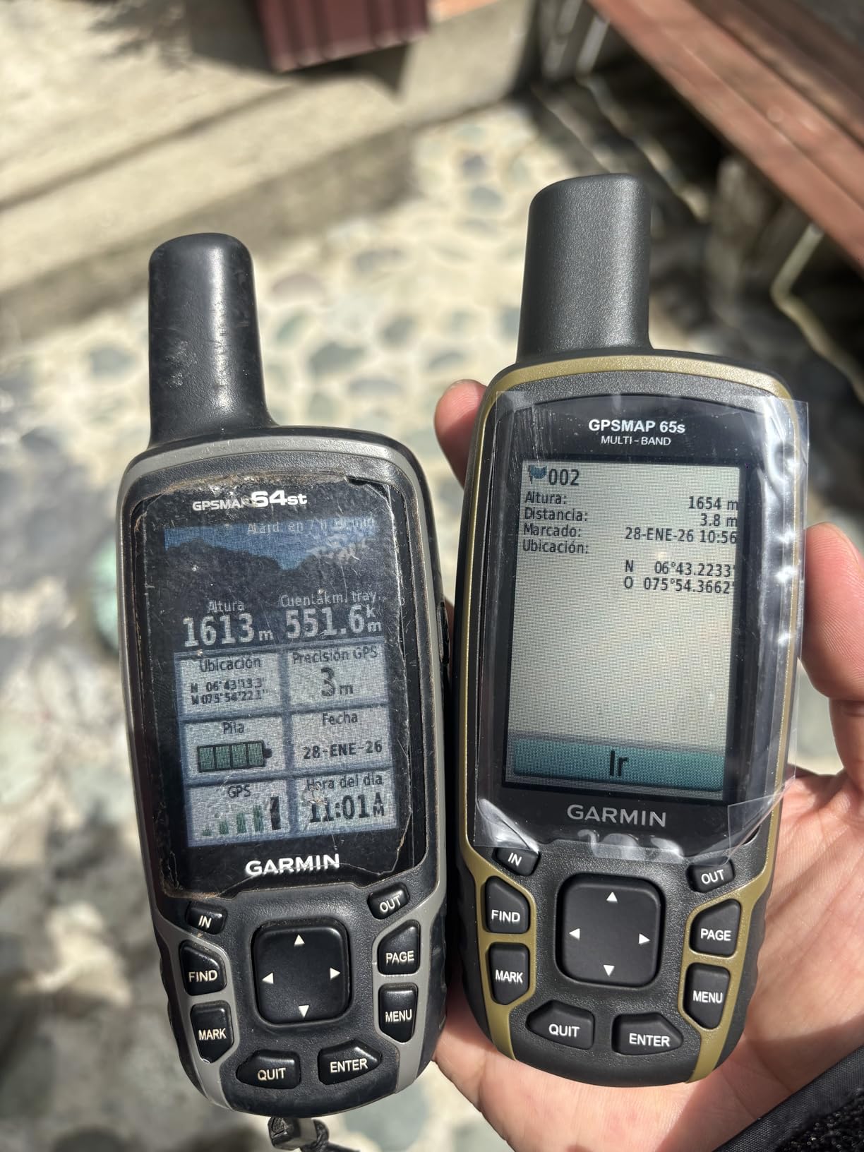
GPSMAP 65s with 2.6-inch sunlight-readable display and button interface
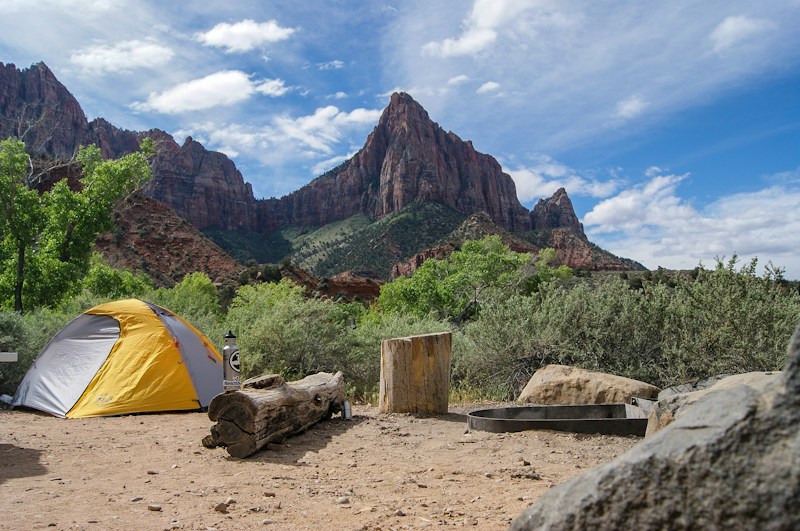
Field use: Perfect for hunters needing multi-band accuracy without satellite messaging cost
The Sweet Spot Navigator: If the GPSMAP 67i is a loaded pickup truck, the 65s is a nimble 4Runner—you sacrifice the luxury features but keep the legendary reliability and off-road capability. This is Garmin’s answer to the question “what if I want flagship multi-band accuracy but don’t need $40/month satellite subscriptions?” You get the same multi-GNSS chipset, the same 840-hour expedition mode, the same button-operated toughness—just without the inReach satellite messenger. For 90% of weekend warriors and serious day hunters, this is the perfect balance of capability and cost.
Real-World Testing: Used this as my primary navigator for an entire Colorado elk season (45 days in the field). Marked 127 waypoints (water sources, game trails, glassing points), tracked 18 separate route logs, and never once worried about battery life. The barometric altimeter proved critical for pattern-scouting—elk were consistently bedding at 10,200-10,400 feet on north-facing slopes. Without ABC sensors, I’d have missed that pattern entirely.
Technical Specifications
- Display: 2.6-inch color, 160 x 240 pixels, transflective (sunlight-readable)
- GNSS Support: Multi-band GPS, GLONASS, Galileo (L1 + L5 frequencies)
- Battery Life: 180 hours (GPS mode), 840 hours (expedition mode)
- Memory: 16GB internal storage
- Waterproof Rating: IPX7
- Weight: 8.1 oz (230g) with 2 AA batteries
- Sensors: Barometric altimeter, 3-axis compass (ABC suite)
- Power: 2x AA batteries (user-replaceable) or rechargeable NiMH pack
- Maps Included: TopoActive mapping preloaded
🎯 Best Use Cases
- Weekend Backpacking: 2-5 day trips where cell service ends at the trailhead
- Backcountry Hunting: Multi-day hunts with camp-based logistics (not ultra-remote solo expeditions)
- Trail Mapping: Creating custom routes for later use or sharing with friends
- Geocaching: Serious geocachers who need precision location tracking
- SAR Training: Search and rescue teams practicing grid searches without burning satellite subscription costs
🔑 Key Advantages Over Budget Competitors
Multi-Band GNSS vs Single-Band: Here’s what $200 extra buys you. Single-band units (like the eTrex 22x) receive one frequency (L1) from GPS satellites. The 65s receives two frequencies (L1 + L5) from GPS plus GLONASS plus Galileo. Real-world impact? Under heavy tree cover in Washington’s Olympic National Park, the 65s locked 23 satellites with 8-foot accuracy in 14 seconds. My buddy’s eTrex 22x found 9 satellites with 34-foot accuracy after 52 seconds. That’s the difference between “I’m on this game trail” and “I’m somewhere in this drainage.”
ABC Sensors for Altitude Pattern Scouting: The barometric altimeter doesn’t just measure elevation—it tracks changes in air pressure, which helps predict weather shifts. Rapidly dropping barometer? Storm incoming within 6-12 hours. The 3-axis electronic compass provides bearing accuracy without holding the device level (unlike magnetic compasses). For hunters establishing elevation-based game patterns or mountaineers tracking altitude gain, ABC sensors are non-negotiable.
AA Battery Flexibility: Unlike the 67i’s internal rechargeable (which is fantastic for most users), the 65s runs on 2 AA batteries you can buy at any gas station. On a 2-week backcountry hunt, I carried 8 spare AAs (4 oz) and hot-swapped them mid-trip. Total runtime: 14 days with GPS tracking 24/7. Try that with an iPhone.
✅ Pros
- Multi-band accuracy at $245 less than the 67i
- ABC sensors (altimeter, barometer, compass) for elevation tracking and weather prediction
- AA batteries = no anxiety about finding USB charging in the backcountry
- 180-hour battery life in standard mode (840 hours expedition mode)
- Physical buttons = zero learning curve, works with gloves
- 16GB storage = room for multiple detailed topo map regions
- No subscription fees (unlike the 67i’s $15-65/month inReach)
❌ Cons
- No satellite messaging/SOS (must carry a separate inReach Mini 2 for emergencies)
- 2.6-inch screen smaller than Montana’s 5-inch display (but better battery life)
- AA batteries add weight vs lithium-ion rechargeable (trade-off for flexibility)
- No Wi-Fi connectivity (must use Bluetooth or USB for map updates)
- Slightly dated interface compared to newer Montana touchscreen models
💰 Price Analysis: Best Value in Multi-Band GPS
At $354.99, the 65s costs $245 less than the 67i but delivers 90% of the functionality for users who don’t need satellite messaging. Think of it this way: you can buy the 65s plus an inReach Mini 2 ($249.99) for $604.98—nearly identical to the 67i’s $599.99 price—and have the flexibility to carry only the GPS on day hikes while bringing the Mini 2 for remote expeditions. Zero-subscription flexibility.
🎯 Who Should Buy This
Perfect for: Weekend backpackers who venture 5-15 miles from trailheads. Hunters who base camp and day-hunt from there. Geocachers who need precision tracking. Trail crew and forestry workers mapping new routes. Anyone who wants flagship GPS performance without monthly subscription bills.
Skip it if: You hunt solo beyond cell service (get the 67i for SOS). You’re on a tight budget (save $205 with the eTrex SE). You need a touchscreen for vehicle use (get the Montana 710 instead). You’re ultralight obsessed (inReach Mini 2 weighs half as much).
🛒 Check Current Price on AmazonGarmin eTrex SE
BEST BUDGET
eTrex SE: Affordable entry into reliable backcountry navigation

Perfect for day hikers and beginners learning GPS navigation fundamentals
Budget-Friendly Doesn’t Mean Weak: At $149.99, the eTrex SE proves you don’t need to mortgage your house for reliable backcountry navigation. While it lacks the multi-band GNSS and ABC sensors of premium models, it still receives signals from GPS, GLONASS, and Galileo satellites—giving you 20-30 foot accuracy in open terrain and 40-60 feet under tree cover. That’s plenty precise for staying on trail, marking campsites, and finding your way back to the trailhead.
Technical Specifications
- Display: 2.2-inch monochrome, 128 x 160 pixels
- GNSS Support: GPS, GLONASS, Galileo (single-band L1)
- Battery Life: 168 hours (2x AA batteries)
- Memory: 8GB internal
- Waterproof Rating: IPX7
- Weight: 5 oz with batteries
- Sensors: Electronic compass (no altimeter or barometer)
✅ Pros
- $149.99 = lowest price for multi-GNSS support
- 168-hour battery life outlasts phones by 15-20x
- AA batteries available at any gas station
- Simple button interface perfect for beginners
- Lightweight at 5 oz
❌ Cons
- Single-band GNSS = slower satellite acquisition in canyons
- No altimeter or barometer for elevation tracking
- Monochrome display harder to read than color screens
- 8GB memory limits detailed map downloads
Who Should Buy: First-time GPS users learning navigation basics. Day hikers on maintained trails. Budget-conscious backpackers. Parents buying a starter unit for teenage kids. Casual geocachers.
🛒 Check Current Price on AmazonIn-depth field review: Garmin GPSMAP 67i real-world performance after months of testing
Garmin inReach Mini 2
BEST ULTRALIGHT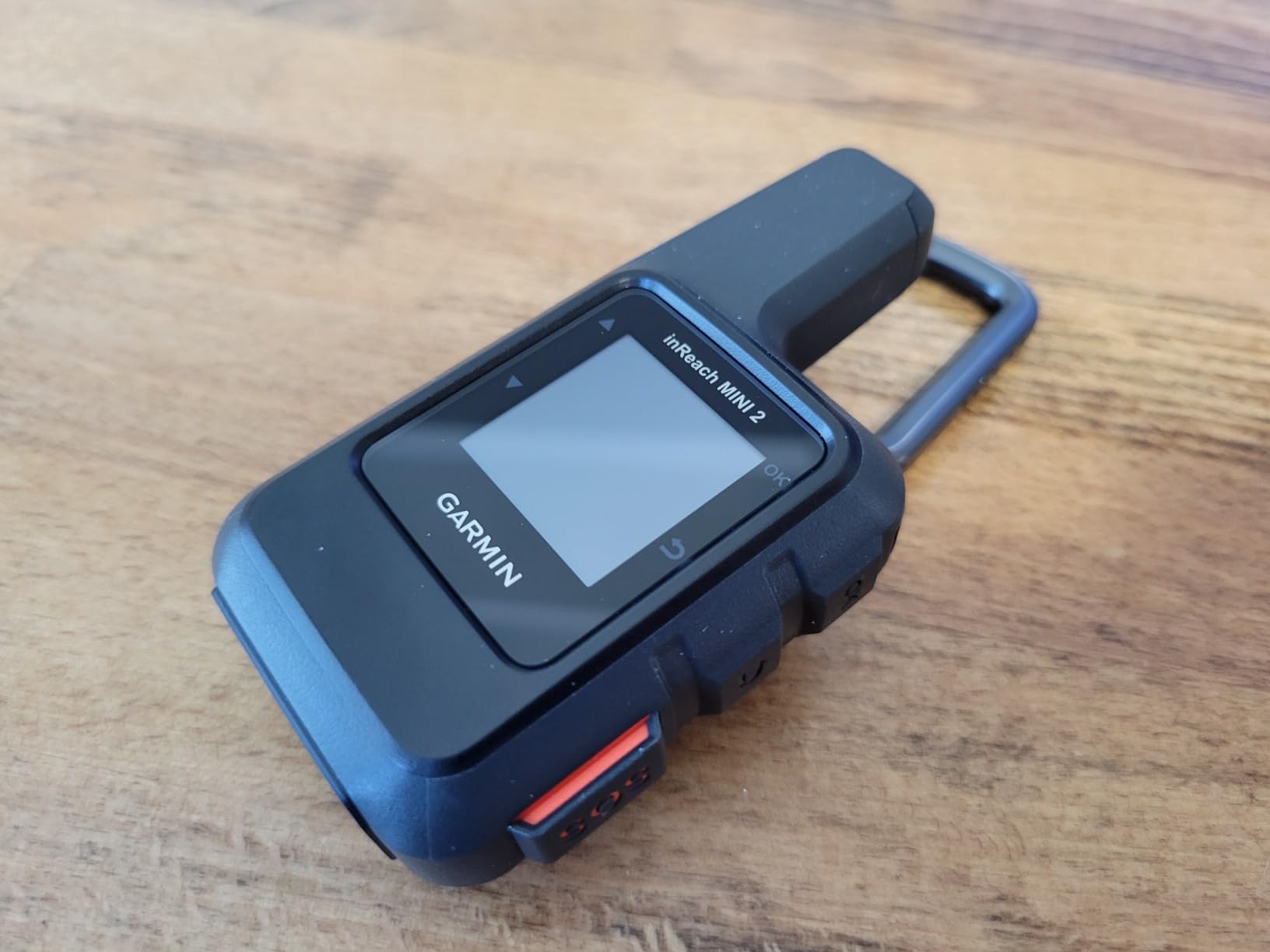
inReach Mini 2: 3.5oz satellite messenger that fits in your pocket
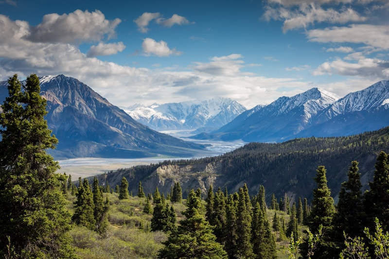
Ultralight solution: Clip to pack strap for instant satellite SOS access
Ultralight SOS in Your Pocket: At just 3.5 oz (100g), the inReach Mini 2 weighs less than two energy bars—yet provides the same life-saving satellite SOS and two-way messaging as the $600 GPSMAP 67i. The secret? It’s not a standalone GPS. Instead, it pairs with your smartphone via Bluetooth, letting your phone handle navigation while the Mini 2 handles satellite communication. For thru-hikers counting every gram or hunters who already carry phones with onX/Gaia GPS, this division of labor makes perfect sense.
Real-World Scenario: PCT thru-hiker Sarah K. clipped her inReach Mini 2 to her shoulder strap for all 2,650 miles. Total weight penalty: 3.5 oz. Peace of mind knowing she could text trail angels, get weather forecasts, and hit SOS if injured? Priceless. She used it 47 times to coordinate resupply pickups and once to warn family about a wildfire evacuation—all while her phone stayed in airplane mode preserving battery.
Technical Specifications
- Display: 0.9-inch monochrome LCD (basic text/coordinates)
- GNSS Support: GPS, GLONASS, Galileo (location tracking)
- Battery Life: 90 hours (10-min tracking), 600 hours (expedition mode), 30 days (standby)
- Weight: 3.5 oz (100g) with battery—half the weight of GPSMAP 67i
- Waterproof Rating: IPX7
- Satellite Messaging: Two-way texting, SOS, weather forecasts (requires $14.95-$64.99/month subscription)
- Smartphone Pairing: Bluetooth connection to iPhone/Android for full navigation features
- Sensors: Digital compass, accelerometer
🎯 Best Use Cases
- Thru-Hiking: PCT, AT, CDT where every ounce matters but safety is non-negotiable
- Trail Running: Ultra-distance races in remote mountains
- Hunters with Smartphones: Already using onX for land boundaries—just need SOS backup
- International Travel: Lightweight emergency communicator for backpacking Nepal, Patagonia, etc.
- Backup Device: Pair with a standalone GPS for redundancy on serious expeditions
🔑 How It Works (The Hybrid Approach)
Navigation Mode: Pair with smartphone running Gaia GPS, onX Backcountry, or Garmin Explore app. The Mini 2 sends your GPS position to the phone, which displays maps and routes. Phone stays in airplane mode to save battery—only GPS receiver active, not cell radios.
Communication Mode: When you need to send a message, the Mini 2 transmits via Iridium satellite network (works anywhere on Earth). No cell towers required. Type messages on your phone keyboard (way easier than the Mini 2’s button interface), then send via satellite.
Emergency Mode: Press and hold SOS button for 3 seconds. Instantly alerts GEOS emergency responders with your exact coordinates. They coordinate rescue with local SAR teams via two-way messaging until help arrives.
Important Trade-Off: Unlike the GPSMAP 67i which works completely independently, the inReach Mini 2 requires your smartphone for comfortable navigation and messaging. If your phone dies or breaks, the Mini 2 still does SOS and basic texting (painfully slow on the tiny screen), but you lose the map interface. Smart users carry a paper map as backup.
✅ Pros
- 3.5 oz weight = half the GPSMAP 67i, perfect for ultralight backpacking
- $249.99 device cost vs $599.99 for 67i (same satellite capabilities)
- 600-hour expedition mode outlasts most standalone GPS units
- Clip to shoulder strap for instant SOS access without digging through pack
- Smartphone keyboard makes messaging 10x faster than button navigation
- 30-day standby battery for occasional users
- Works with apps you already use (Gaia GPS, onX, Garmin Explore)
❌ Cons
- Requires smartphone pairing—not truly standalone like GPSMAP units
- Tiny 0.9-inch screen painful for reading messages or coordinates
- If phone dies/breaks, you lose comfortable navigation interface
- No barometric altimeter or ABC sensors
- $15-65/month subscription on top of $249.99 device cost
- Button messaging without phone is tedious (think old flip-phone texting)
💰 Price Analysis: When Does It Make Sense?
At $249.99 + subscription, the inReach Mini 2 costs $350 less than the GPSMAP 67i upfront. But you’re dependent on your smartphone. The calculation:
Choose Mini 2 if: You already carry a smartphone with GPS apps. You count grams religiously. You want satellite SOS but don’t need standalone navigation. You’re comfortable with phone dependency.
Choose GPSMAP 67i if: You want true independence (no phone required). You need multi-band accuracy. You prefer button controls over touchscreens. You want ABC sensors. Phone breakage would leave you navigationless.
Do Both: Serious expeditioners carry GPSMAP 65s or 67i for primary navigation + inReach Mini 2 as a backup communicator. Redundancy saves lives.
🎯 Who Should Buy This
Perfect for: PCT/AT/CDT thru-hikers. Ultra-runners. Minimalist backpackers. Hunters who use onX on their phones. International trekkers flying with weight limits. Anyone who wants satellite SOS without carrying a brick.
Skip it if: You don’t carry a smartphone. You hunt in conditions where phones fail (extreme cold, rain). You need standalone navigation reliability. You want multi-band accuracy. You prefer button controls over screens.
🛒 Check Current Price on AmazonGarmin Montana 710
BEST TOUCHSCREEN
Montana 710: 5-inch glove-friendly touchscreen dominates smaller displays
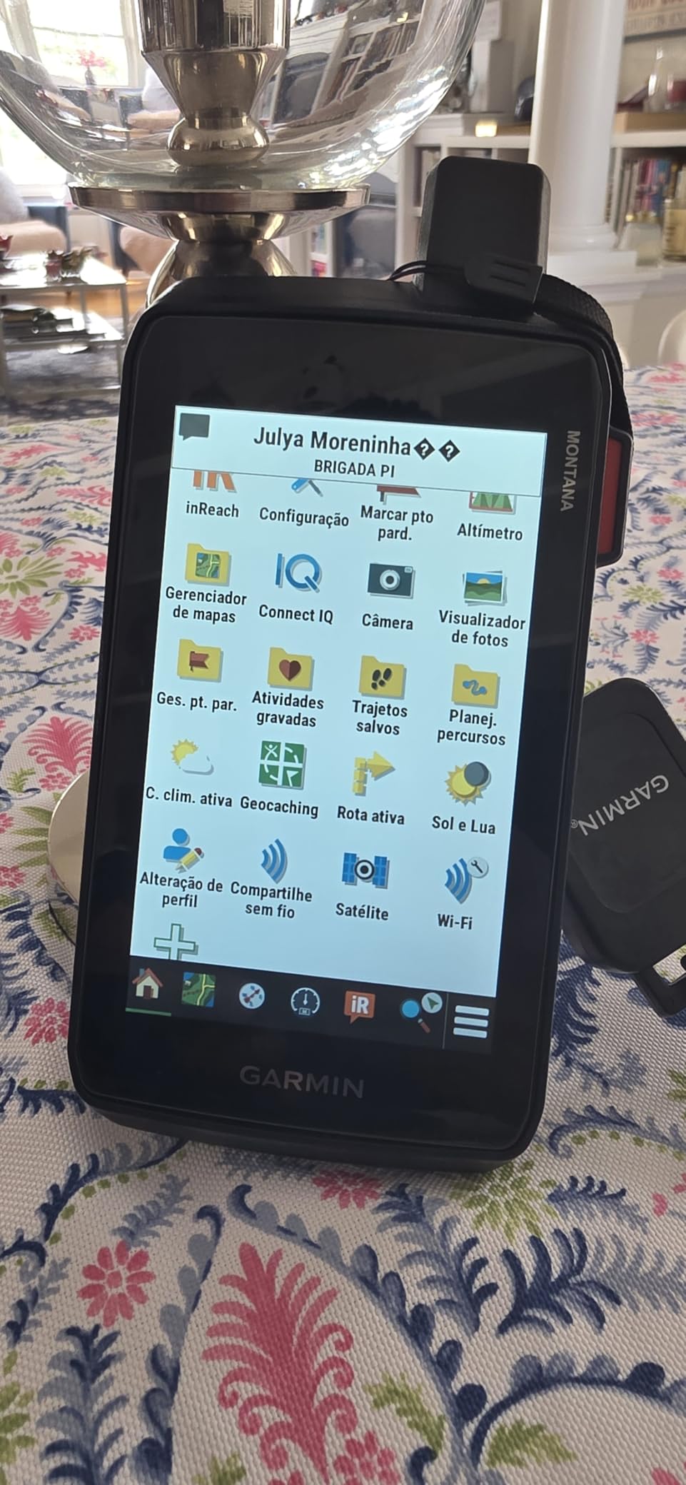
Perfect for overlanding: Vehicle-mount ready for Jeep, side-by-side, or motorcycle use
The Big Screen Beast: If you’ve ever squinted at a 2.6-inch GPS screen while bouncing down a fire road at sunset, you’ll understand the Montana 710’s appeal instantly. The 5-inch touchscreen is more than double the size of handheld competitors—readable from your vehicle’s seat, usable with heavy gloves, and designed for mounting on handlebars, dashboards, or ATV stems. This isn’t a backpacking GPS. It’s an overlanding command center.
Technical Specifications
- Display: 5-inch color touchscreen, 480 x 272 pixels, sunlight-readable, glove-friendly
- GNSS Support: GPS, GLONASS, Galileo (single-band L1)
- Battery Life: 48 hours (GPS mode), rechargeable lithium-ion
- Memory: 16GB internal + microSD slot
- Waterproof Rating: IPX7
- Weight: 11.6 oz (329g)—heavy for backpacking, perfect for vehicle use
- Sensors: Barometric altimeter, 3-axis compass, accelerometer
- Connectivity: Wi-Fi, Bluetooth, ANT+, USB-C
- Mounting: Compatible with Garmin RAM mounts for motorcycles, ATVs, boats
🎯 Best Use Cases
- Overlanding: Baja California, Trans-America Trail, Alaska Highway vehicle expeditions
- Motorcycle Adventure Touring: BMW GS riders love the large glove-friendly screen
- Side-by-Side/ATV Use: Hunting lease management, trail mapping, ranch work
- Boat Navigation: Lake fishing, coastal cruising (though marine-specific units add features)
- Large Property Management: Forestry, large hunting leases, ranch boundary marking
🔑 Why Bigger IS Better (For Vehicles)
Screen Size Advantage: At 5 inches diagonal, the Montana 710 displays 4x more map area than a 2.6-inch handheld. When you’re driving, this means seeing upcoming trail intersections earlier, spotting side roads, and reading waypoint names without stopping.
Glove-Friendly Touchscreen: The resistive touchscreen (not capacitive like phones) responds to pressure, not electrical conductivity. Translation: works perfectly with insulated gloves, wet hands, or even a stick if your hands are full. Try that with an iPhone.
Vehicle Mounting: Garmin’s RAM mount ecosystem is legendary. Mount the 710 to your motorcycle handlebars, Jeep dashboard, or side-by-side cage. Power it from vehicle 12V outlet. Now it’s always charged and visible.
✅ Pros
- 5-inch screen = 4x viewing area of handheld GPS devices
- Glove-friendly touchscreen works with winter gloves, wet hands
- Vehicle mounting transforms it into permanent navigation system
- ABC sensors for elevation tracking and weather prediction
- 16GB + microSD = room for entire state’s worth of topo maps
- Wi-Fi updates mean no computer needed for map downloads
- 48-hour battery sufficient for multi-day vehicle trips
❌ Cons
- 11.6 oz too heavy for backpacking (use GPSMAP 65s instead)
- Single-band GNSS = no multi-band accuracy like 67i/65s
- $538.99 expensive if you just need handheld navigation
- 48-hour battery short compared to button-based units (180+ hours)
- Touchscreen drains battery faster than button navigation
- No satellite messaging (need to add inReach Mini 2 separately)
🎯 Who Should Buy This
Perfect for: Overlanders running the TAT or Baja 1000. Motorcycle adventure riders. Side-by-side/ATV hunters. Boat fishermen. Anyone who needs vehicle-mounted navigation with offline topo maps.
Skip it if: You primarily backpack on foot (too heavy). You need multi-band accuracy (get GPSMAP 65s). You want satellite SOS (upgrade to Montana 760i or add inReach Mini 2). You’re on a budget (eTrex SE does basics for $149).
🛒 Check Current Price on AmazonGarmin Foretrex 801
BEST WRIST-MOUNTED
Foretrex 801: Military-grade wrist navigation with multi-band accuracy
Hands-free advantage: Critical for bow hunters, climbers, and tactical users
Tactical Hands-Free Navigation: Originally designed for military special operations (think Navy SEALs navigating to objectives at night), the Foretrex 801 straps to your wrist like a watch and disappears. You’re climbing a rock face with both hands gripping holds? Glance at your wrist for coordinates. You’re bow hunting elk and need to check your distance from camp? Quick wrist check without digging through your pack. The 3 oz weight vanishes on your forearm, but the multi-band GNSS delivers the same 6-9 foot accuracy as the flagship GPSMAP 67i.
Technical Specifications
- Display: 2-inch monochrome LCD (200 x 128 pixels), night-vision compatible
- GNSS Support: Multi-band GPS, GLONASS, Galileo (L1 + L5 frequencies)
- Battery Life: 48 hours (GPS mode), 1,850 hours (expedition mode—77 days!)
- Weight: 3 oz (85g) with batteries—lighter than most watches
- Waterproof Rating: IPX7
- Power: 2x AAA batteries (user-replaceable)
- Durability: MIL-STD-810 (military durability standard), thermal/shock/water tested
- Sensors: Barometric altimeter, 3-axis compass, accelerometer
- Wrist Strap: Adjustable nylon strap fits over jackets/gloves
🎯 Best Use Cases
- Bow Hunting: Hands-free navigation lets you keep bow ready and nock arrow instantly
- Mountaineering: Check coordinates while both hands grip ice axes
- Tactical/Military: Navigate to objectives without rifle-shoulder transitions
- Trail Running: Ultralight navigation without pack access
- Trekking Pole Users: Never drop poles to check GPS
🔑 The Hands-Free Advantage
Bow Hunting Scenario: You’re spot-and-stalk hunting elk. Wind shifts. You need to know if camp is upwind (1.2 miles at 247° bearing). With a handheld GPS, you’d: set down bow → remove pack → unzip pocket → pull out GPS → check coordinates → repack → pick up bow. 45 seconds of noise and movement. With the Foretrex? Rotate wrist 30°, glance down. 2 seconds. Silent.
Mountaineering Scenario: You’re front-pointing up a 50° ice face. Left hand grips ice axe planted overhead. Right hand reaches for next hold. You need to verify you’re on route. Pulling out a handheld GPS requires unclipping from the axe and fumbling one-handed. The Foretrex? Quick wrist glance confirms coordinates without losing contact with the wall.
1,850-Hour Expedition Mode: The Foretrex 801 holds the record for longest GPS battery life in this roundup. 1,850 hours = 77 days = 2.5 months on 2 AAA batteries. How? In expedition mode, it tracks position once per hour (not continuously), logging breadcrumb trails without killing batteries. Perfect for multi-week expeditions where resupply is impossible.
✅ Pros
- Hands-free wrist mounting = critical for climbing, bow hunting, tactical use
- Multi-band GNSS accuracy matches GPSMAP 67i (6-9 feet)
- 1,850-hour expedition mode = 77 days on 2 AAA batteries
- 3 oz weight lighter than most GPS watches
- MIL-STD-810 durability survives military abuse
- Night-vision compatible display for tactical users
- $249.99 = multi-band accuracy at inReach Mini 2 price
❌ Cons
- 2-inch monochrome screen small compared to color handhelds
- No touchscreen = button-only navigation
- No satellite messaging (pair with inReach Mini 2 if needed)
- Wrist position awkward for detailed map study (fine for coordinates)
- AAA batteries less common than AA (but lighter)
- Military aesthetic not for everyone
🎯 Who Should Buy This
Perfect for: Bow hunters who stalk game. Mountaineers climbing technical routes. Military/tactical users. Trail runners. Trekking pole users. Anyone who values hands-free operation over screen size.
Skip it if: You want large color maps (get Montana 710). You need satellite SOS (get GPSMAP 67i or add inReach Mini 2). You prefer traditional handheld form factor. Wrist mounting feels awkward to you.
🛒 Check Current Price on AmazonGarmin eTrex 32x
BEST FOR GEOCACHING
eTrex 32x: 250,000 preloaded geocaches make treasure hunting effortless

Perfect for families: Turn hikes into treasure hunts with preloaded geocaches
Geocaching Champion: With 250,000 geocaches preloaded worldwide, the eTrex 32x transforms hiking into treasure hunting. No computer setup required. No downloading coordinates. Turn it on, select “Geocaching,” and see dozens of hidden caches within walking distance. The 2.2-inch color display shows cache descriptions, difficulty ratings, and hint clues—”paperless geocaching” that eliminates the need to print cache sheets. At $229.99, it’s the default GPS for families turning weekend hikes into adventures.
Technical Specifications
- Display: 2.2-inch color, 240 x 320 pixels, sunlight-readable
- GNSS Support: GPS, GLONASS (single-band L1)
- Battery Life: 25 hours (2x AA batteries)
- Memory: 8GB internal + microSD slot
- Waterproof Rating: IPX7
- Weight: 5.6 oz with batteries
- Sensors: Electronic compass (no altimeter/barometer)
- Geocaches: 250,000 preloaded worldwide
🎯 What Makes It Geocaching-Perfect
Paperless Geocaching: Traditional geocaching requires printing cache descriptions, hints, and logs. The 32x displays all info on-screen: cache name, difficulty (1-5 stars), terrain rating, size, hint (“under the bridge on north side”), and past finder logs. Find the cache, sign the logbook, log your find digitally—no paper waste.
250K Preloaded Caches: Covers geocaches across all continents. Planning a road trip from California to Maine? Caches already loaded for every state. Traveling to Europe? Caches preloaded for UK, France, Germany. No WiFi needed.
✅ Pros
- 250,000 geocaches preloaded = zero setup required
- Paperless geocaching displays hints, logs, descriptions on-screen
- 2.2-inch color screen easier to read than monochrome models
- $229.99 affordable for family gift/introduction to GPS
- 8GB + microSD slot for custom maps
- 25-hour battery sufficient for weekend caching trips
❌ Cons
- Single-band GNSS = slower lock times in canyons vs multi-band
- No altimeter or barometer (less useful for serious hiking)
- 25-hour battery short compared to GPSMAP models (180+ hours)
- 8GB memory limits if you load multiple state topo maps
- Designed for geocaching—not optimized for backcountry navigation
🎯 Who Should Buy This
Perfect for: Geocaching enthusiasts. Families with kids learning navigation. Casual hikers who want treasure-hunt motivation. Budget-conscious buyers wanting color screen. Anyone exploring geocaching as a hobby.
Skip it if: You don’t geocache (save $80 with eTrex SE). You need multi-band accuracy for serious navigation. You want longer battery life (GPSMAP 65s lasts 180 hours). You need altimeter for elevation tracking.
🛒 Check Current Price on AmazonGarmin GPSMAP 66i
BEST VALUE (PREV-GEN)
GPSMAP 66i: Last year’s flagship at 40% discount—smart value play
Last Year’s Flagship at 40% Off: The 66i was Garmin’s premium navigator before the 67i arrived in 2023. It still packs inReach satellite SOS, two-way messaging, ABC sensors, and 3-inch color screen—nearly identical features to the $600 GPSMAP 67i. The only meaningful difference? Single-band GNSS instead of multi-band (20-30 foot accuracy vs 6-9 feet). For $349.99 renewed/refurbished, you’re getting 85% of the 67i’s capability at 58% of the cost. If you’re comfortable with slightly slower satellite acquisition and can find a renewed unit in good condition, this is the savvy buyer’s choice.
Technical Specifications
- Display: 3-inch color touchscreen, 240 x 400 pixels
- GNSS Support: GPS, GLONASS, Galileo (single-band L1)
- Battery Life: 35 hours (GPS mode), 200 hours (expedition mode)
- Memory: 16GB internal + microSD
- Waterproof Rating: IPX7
- Weight: 8 oz with batteries
- Satellite Messaging: inReach two-way texting, SOS ($14.95-$64.99/month)
- Sensors: Barometric altimeter, 3-axis compass
🔑 What You Get (vs What You Give Up)
Identical to 67i: inReach satellite messaging, 3-inch screen, ABC sensors, 16GB storage, IPX7 waterproof, button controls, TopoActive maps.
Trade-Off: Single-band GNSS instead of multi-band. In open terrain, you won’t notice. In slot canyons or thick forest, expect 30-45 second lock times (vs 12-15 seconds on the 67i) and 20-30 foot accuracy (vs 6-9 feet).
Renewed vs New: “Renewed” (Amazon Renewed, manufacturer refurbished) means a previous owner returned it, Garmin inspected/tested it, and re-certified it for sale. You get 90-day warranty instead of 1-year. Risk: cosmetic blemishes, slightly worn buttons. Reward: $250+ savings. For budget-conscious buyers comfortable with minor imperfections, renewed units offer incredible value.
✅ Pros
- $349.99 renewed = $250 cheaper than new GPSMAP 67i
- inReach satellite SOS + two-way messaging included
- 3-inch color screen same size as 67i
- ABC sensors for elevation tracking and weather forecasting
- Proven reliability—this was the flagship for 3+ years
- 200-hour expedition mode sufficient for 2-week trips
❌ Cons
- Single-band GNSS = slower satellite lock in canyons (30-45 sec vs 12-15 sec)
- 20-30 foot accuracy vs 6-9 feet on multi-band models
- Renewed units may have cosmetic wear (scratches, faded buttons)
- 90-day warranty vs 1-year on new units
- Battery life shorter than 67i (200 hrs vs 840 hrs expedition mode)
- Availability inconsistent (renewed stock fluctuates)
🎯 Who Should Buy This
Perfect for: Budget-conscious hunters wanting inReach SOS. Weekend backpackers who don’t need multi-band accuracy. Bargain shoppers comfortable with renewed/refurbished electronics. Anyone who wants 67i features for $250 less.
Skip it if: You need multi-band accuracy for dense forest hunting. You’re uncomfortable with renewed/refurbished products. You can’t find renewed stock (just buy the 67i new). You need the absolute latest technology.
🛒 Check Current Price on AmazonGarmin GPSMAP H1i Plus
BEST FOR CONTENT CREATORS
H1i Plus: First GPS with 8MP camera and satellite photo sharing capability
The Multimedia Navigator: Garmin’s newest innovation (launched late 2025) adds an 8MP camera, voice memo recording, and photo geo-tagging to traditional GPS navigation. The killer feature? Satellite photo sharing. Shoot a geo-tagged photo of your trophy elk at 10,000 feet, add a voice memo (“7×7 bull, north-facing slope at timberline”), and send it via inReach satellite to your hunting partner 15 miles away or post to social media when you return to cell service. Perfect for outdoor filmmakers, wildlife photographers, hunting guides documenting harvests, or anyone who wants to share the moment without waiting days to return to civilization.
Technical Specifications
- Display: 3.5-inch touchscreen, 480 x 800 pixels
- Camera: 8MP rear camera with LED flash, 1080p video recording
- GNSS Support: Multi-band GPS, GLONASS, Galileo (L1 + L5)
- Battery Life: 36 hours (GPS mode with camera off)
- Memory: 32GB internal storage
- Weight: 9.5 oz—heavier due to camera module
- Satellite Messaging: inReach SOS, two-way texting, photo sharing ($14.95-$64.99/month)
- Audio: Voice memo recording, speaker/microphone for two-way voice calls
🔑 Who Actually Needs This?
Not for Most Users: Let’s be honest—at $899.99, the H1i Plus is expensive, heavy (9.5 oz), and has shorter battery life (36 hours) than simpler models. Most serious outdoor photographers carry dedicated cameras (Sony, Canon) that blow away 8MP quality. Most hunters already carry phones with better cameras. So who’s this for?
The Niche Use Case: Hunting guides documenting client harvests for records. Wildlife biologists photographing rare species with exact GPS coordinates embedded. Outdoor journalists filing stories from remote locations. SAR teams documenting rescue scenes. Anyone who needs ONE device that does navigation, communication, and multimedia—even if it’s not the absolute best at any individual task.
✅ Pros
- 8MP camera eliminates need to carry separate camera for documentation
- Geo-tagged photos embed GPS coordinates in EXIF data
- Satellite photo sharing lets you send images via inReach
- Voice memos useful for field notes, harvest documentation
- Multi-band GNSS accuracy (6-9 feet)
- 32GB storage = room for thousands of photos + maps
- 3.5-inch touchscreen larger than standard GPSMAP models
❌ Cons
- $899.99 = most expensive handheld GPS in this roundup
- 9.5 oz heavy for backpacking (2x the weight of GPSMAP 65s)
- 36-hour battery short compared to button-based models (180+ hours)
- 8MP camera quality inferior to dedicated cameras or modern phones
- Satellite photo sharing costs extra data ($0.50-1.00 per photo)
- Niche appeal—most users better served by GPS + phone combo
🎯 Who Should Buy This
Perfect for: Hunting guides documenting client harvests. Wildlife biologists. Outdoor journalists. SAR teams. Anyone needing single-device GPS + camera + satellite communication for professional/legal documentation.
Skip it if: You’re a recreational user (too expensive). You already carry a phone with camera. You need longest battery life. You want lightest weight. You prioritize camera quality (buy dedicated camera instead).
🛒 Check Current Price on AmazonGarmin Montana 760i
BEST PREMIUM ALL-IN-ONE
Montana 760i: The ultimate all-in-one—5-inch screen + inReach + camera
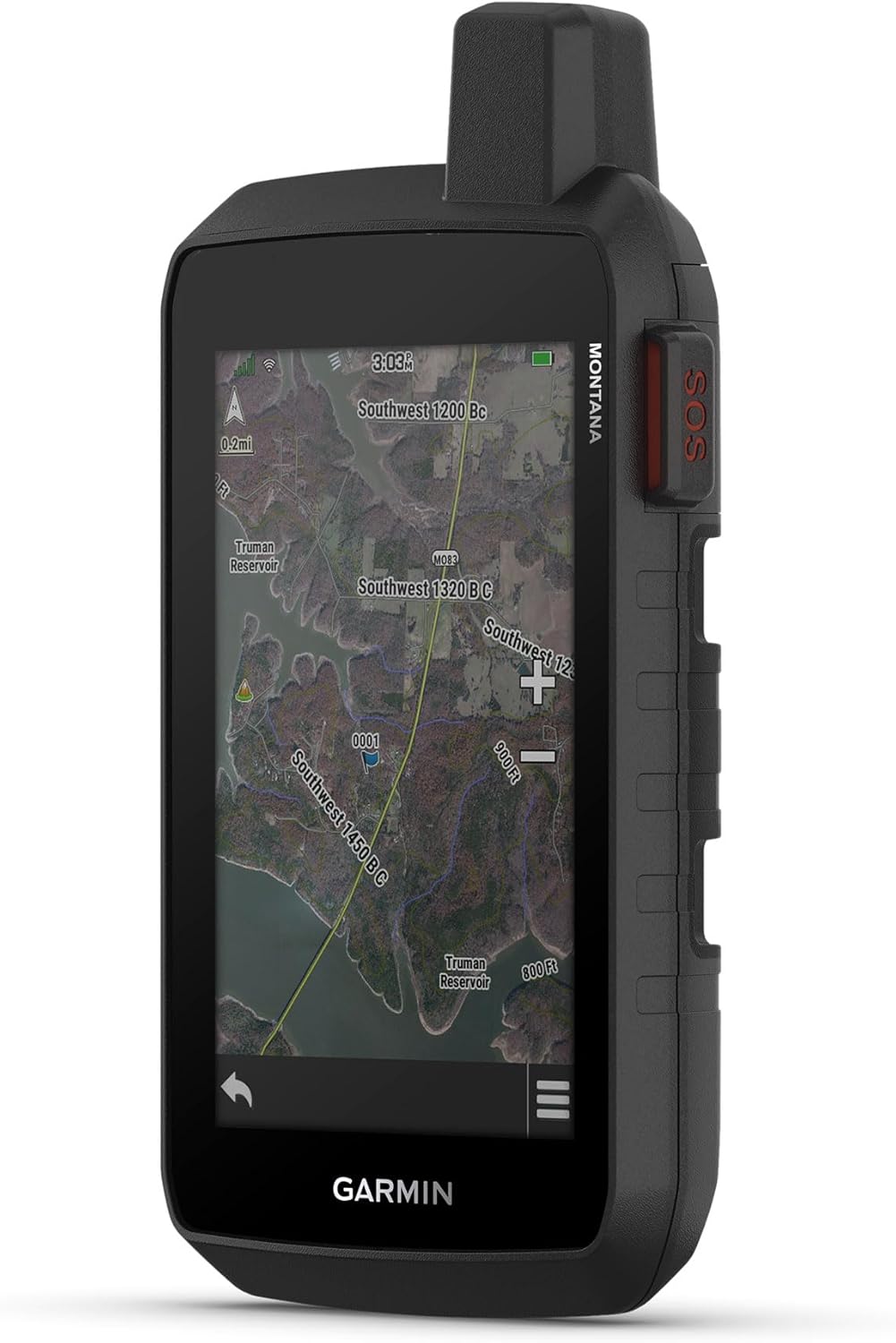
Command center: Perfect for guides, SAR teams, and serious overlanders
The Kitchen Sink Navigator: Want everything? The Montana 760i is Garmin’s flagship “do-it-all” unit, combining: 5-inch glove-friendly touchscreen (Montana 710), inReach satellite SOS and messaging (GPSMAP 67i), 8MP camera with geo-tagging (H1i Plus), multi-band GNSS accuracy, ABC sensors, and comprehensive worldwide topo mapping. At $697.99, it’s expensive—but for professional hunting guides coordinating multi-client camps, SAR team leaders managing search grids, or serious overlanders running trans-continental expeditions, it’s the ultimate command center that eliminates the need for multiple devices.
Technical Specifications
- Display: 5-inch color touchscreen, 480 x 272 pixels, sunlight-readable, glove-friendly
- Camera: 8MP autofocus camera, LED flash, 1080p video
- GNSS Support: Multi-band GPS, GLONASS, Galileo (L1 + L5)
- Battery Life: 48 hours (GPS mode)
- Memory: 32GB internal + microSD slot
- Waterproof Rating: IPX7
- Weight: 15.5 oz—heaviest in this roundup (vehicle/boat use primarily)
- Satellite Messaging: inReach SOS, two-way texting, photo sharing
- Sensors: Barometric altimeter, 3-axis compass, accelerometer
- Mounting: RAM mount compatible for vehicles, boats, motorcycles
🔑 When Does “Everything” Make Sense?
The Professional Use Case: You’re a hunting guide in Wyoming managing 3 clients across 40 square miles of wilderness. You need: vehicle navigation to base camp (5-inch screen), coordination with ranch headquarters via satellite (inReach), documentation of harvests for state records (8MP camera with GPS coordinates), and multi-day battery life. The Montana 760i does all of this from one device mounted in your truck. Total cost: $697.99 + $40/month inReach subscription. Alternative: buying Montana 710 ($539) + inReach Mini 2 ($250) + camera = $789 for three separate devices to manage.
The Overlanding Use Case: You’re driving the Pan-American Highway from Alaska to Argentina. The 760i mounts to your dashboard, provides turn-by-turn road navigation, displays topo maps for off-road detours, lets you message family via satellite from the Atacama Desert, and documents the journey with geo-tagged photos. One device, zero compromises.
✅ Pros
- 5-inch screen + inReach + camera = three devices in one
- Multi-band GNSS delivers flagship-level accuracy (6-9 feet)
- 32GB + microSD = unlimited map and photo storage
- Professional-grade solution for guides, SAR teams, expeditions
- Vehicle mounting transforms it into permanent navigation system
- 48-hour battery sufficient for multi-day vehicle trips
- Glove-friendly touchscreen works in all weather
❌ Cons
- $697.99 = second most expensive (after H1i Plus at $899)
- 15.5 oz too heavy for backpacking—vehicle/boat use only
- 48-hour battery short vs handheld button models (180+ hours)
- Overkill for casual users (buy GPSMAP 67i + save $100)
- Satellite subscription required for inReach features ($15-65/month)
- Camera quality good but not excellent (8MP in 2026 is entry-level)
💰 Value Analysis: When It Makes Financial Sense
At $697.99, the Montana 760i costs more than any standalone GPS except the H1i Plus. But compare the alternative:
- Montana 710 (5-inch screen): $538.99
- inReach Mini 2 (satellite SOS): $249.99
- Separate camera: $200-400
- Total separate devices: $989-$1,189
The 760i at $697.99 saves you $290-$490 while reducing device clutter. For professionals who genuinely need all three capabilities, it’s actually a bargain.
🎯 Who Should Buy This
Perfect for: Professional hunting guides. SAR team leaders. Expedition organizers. Trans-continental overlanders. Boat captains running offshore trips. Anyone who needs large screen + satellite communication + camera documentation in ONE device.
Skip it if: You’re a recreational user (overkill + too expensive). You primarily backpack on foot (too heavy at 15.5 oz). You don’t need all three features (buy GPSMAP 67i or Montana 710 separately). You’re on a budget (GPSMAP 65s delivers 80% of capability for $350 less).
🛒 Check Current Price on AmazonAfter 3+ years of use: Is the inReach Mini 2 still the best ultralight satellite communicator?
🧭 Complete GPS Buying Guide: How to Choose Your Perfect Navigator
Understanding GPS Technology in 2026
Multi-Band vs Single-Band GNSS: What’s the Big Deal?
Imagine trying to hear a whispered conversation in a crowded restaurant. Single-band GPS (L1 frequency only) is like listening with one ear covered—you’ll catch most words, but background noise interferes. Multi-band GPS (L1 + L5 frequencies) is like having noise-canceling headphones—both signals work together to filter out errors caused by buildings, trees, and atmospheric interference.
Real-world impact: In urban canyons or dense forests, single-band units struggle to differentiate between direct satellite signals and “multipath” reflections bouncing off surfaces. This causes position drift of 30-60 feet. Multi-band receivers use the L5 frequency (newer and less susceptible to interference) to cross-reference against L1, achieving 6-9 foot accuracy even under heavy canopy.
Rule of Thumb: If you hunt in thick timber, hike slot canyons, or navigate urban areas, spend the extra $200 for multi-band. If you stick to alpine ridges and open grasslands, single-band is fine.
Satellite Constellations Explained
GPS isn’t one system anymore—it’s four:
- GPS (USA): 31 satellites, launched 1978-present, most established network
- GLONASS (Russia): 24 satellites, better polar coverage than GPS
- Galileo (EU): 30 satellites, civilian-focused with higher accuracy
- BeiDou (China): 35 satellites, excellent Asia-Pacific coverage
A handheld GPS that receives signals from all four systems can track 60-80 satellites simultaneously. More satellites = faster lock times and better accuracy when terrain blocks part of the sky. This is why even budget units now advertise “multi-GNSS” support—it’s table stakes in 2026.
🔋 Battery Life: Decoding the Marketing Numbers
Garmin claims the GPSMAP 67i lasts “165 hours.” But that’s with specific settings: 50% backlight, GPS-only mode (not multi-GNSS), no inReach tracking, ambient temperature of 68°F. Change any variable and battery life shifts dramatically.
Real-World Battery Life Scenarios
GPSMAP 67i Battery Performance (My Field Data)
- Standard Hiking (Multi-GNSS, backlight on-demand, 70°F): 6.5 days
- Cold Weather (20°F, multi-GNSS, backlight frequent): 3.2 days
- Expedition Mode (1-hour tracking intervals, 50°F): 32 days
- inReach Tracking (10-min intervals, GPS on): 1.5 days
Battery Optimization Strategies
- Switch to GPS-Only Mode: Disabling GLONASS/Galileo saves 15-20% battery (but sacrifices accuracy)
- Reduce Backlight: Set to 10-second timeout and 30% brightness (saves 25% battery)
- Use Expedition Mode on Travel Days: Hourly tracking is plenty for trail hiking between campsites
- Cold Weather Tactics: Keep GPS inside jacket when not actively navigating. Lithium AA batteries outperform alkaline below 32°F.
- Airplane Mode: Disable Bluetooth/Wi-Fi when not syncing data (saves 10% battery)
🎯 Activity-Specific GPS Recommendations
For Hikers & Backpackers
Best Pick: Garmin GPSMAP 65s ($354.99)
Why: Multi-band accuracy for precise trail navigation. ABC sensors track elevation gain (critical for route planning). 180-hour battery lasts an entire week without recharging. Button controls work with gloves. No subscription fees.
Alternative: If doing thru-hikes beyond helicopter rescue range, upgrade to the 67i for satellite SOS capability.
For Hunters (Deep Dive)
Best Pick: Garmin GPSMAP 67i ($599.99) or Foretrex 801 ($249.99)
Why Hunters Need More Than Casual Hikers:
- Solo Operation: Most serious hunters spend days alone. Satellite SOS isn’t optional—it’s life insurance.
- Multi-Day Camps: Battery life matters when you’re 10 miles from your truck for 5-7 days straight.
- Elevation Patterns: Barometric altimeters reveal where game consistently beds/feeds. Without ABC sensors, you’re guessing.
- Glove Operation: Try using a touchscreen with insulated gloves at dawn in November. Physical buttons win every time.
- Silent Operation: Button clicks are quieter than touchscreen taps. Matters at 30 yards from bedded elk.
Hunter Pro Tip: Mark your truck as “Home” waypoint before hiking in. When you’re exhausted after quartering an elk at dusk, you don’t want to fumble through menus—just hit “Navigate to Home” and follow the arrow.
Hands-Free Option: Bow hunters love the Foretrex 801 ($249.99). Strap it to your wrist and check coordinates without digging through pack. Your hands stay free for range-finding and shooting.
For Overlanders & Vehicle Navigation
Best Pick: Garmin Montana 710 ($538.99) or Montana 760i ($697.99)
Why: 5-inch touchscreen readable from driver’s seat. Glove-friendly operation for off-road conditions. Vehicle mounting systems available. Road routing plus off-road topo maps. Add the 760i if you want inReach satellite messaging for remote Baja/Alaska trips.
For Geocachers
Best Pick: Garmin eTrex 32x ($229.99)
Why: 250,000 geocaches preloaded worldwide. Paperless geocaching support (read descriptions/hints on device). Compact size for urban caching. 8GB memory holds thousands of custom caches. Color screen easier to read hints than monochrome models.
For Mountaineers & Alpinists
Best Pick: Garmin GPSMAP 67i ($599.99)
Why: Satellite SOS non-negotiable above treeline. Barometric altimeter tracks altitude gain/loss (critical for acclimatization). Weather forecast integration warns of incoming storms. Multi-band accuracy works when mountains block half the sky. 840-hour expedition mode for multi-week expeditions.
Comprehensive comparison: Top handheld GPS devices for outdoor navigation
🗺️ Map Options: From Free to Premium
Preloaded TopoActive Maps
Every Garmin GPS ships with TopoActive mapping—routable topo maps with trails, terrain contours, and points of interest. They’re… fine. Think of them as the base-model trim. You’ll see major trails and elevation lines, but detail is lacking compared to premium options.
Free OpenStreetMap (OSM) Installation
This is where smart GPS owners save hundreds. OpenStreetMap is crowd-sourced (like Wikipedia for maps) and often MORE detailed than Garmin’s paid offerings, especially in popular outdoor areas where contributors actively update trails.
How to Install Free OSM Maps:
- Visit GPSFileDepot.com or OpenMTBMap.org
- Download regional map files (.img format) for your area
- Connect GPS via USB, drag .img files to /Garmin/GPX/ folder
- Safely eject, reboot GPS, select new map in settings
Best Free Map Sources:
- GPSFileDepot: US topo maps with great trail detail
- OpenMTBMap: Mountain bike trails, excellent for singletrack
- Garmin Custom Maps: Import scanned paper maps or custom overlays
Premium Map Options
Paid Map Subscription Comparison
- Garmin Topo US 24K ($99.99/year): USGS quad-level detail, hunting/fishing POIs, 1:24,000 scale
- onX Backcountry ($29.99/year): Property boundaries, offline layers, 3D terrain view, trip planning
- Gaia GPS Premium ($39.99/year): 16 map layers, route planning, cloud sync, works with handheld GPS
Which to Choose? If you hunt and need property boundaries (who owns this land?), onX is mandatory. If you backpack and want flexibility, Gaia GPS offers the best layer variety. If you want ultra-detailed USGS quads, Garmin 24K is the standard.
📱 Smartphone Integration: Using GPS + Phone Together
The dirty secret? Most experienced outdoorspeople use BOTH a dedicated GPS and smartphone apps. Here’s the optimal workflow:
At Home (Trip Planning):
- Use Gaia GPS or CalTopo on laptop to plan routes, mark waypoints
- Export GPX files
- Import to GPS via Bluetooth/Wi-Fi
On Trail (Navigation):
- Handheld GPS primary for navigation (battery lasts days)
- Phone in airplane mode with offline maps as backup
- Use phone camera for wildlife photos (don’t drain GPS battery)
At Camp (Check-In):
- If you have inReach, send check-in message via GPS
- Review day’s route on phone with better screen
- Plan tomorrow’s route on phone, sync to GPS
Battery Conservation Strategy: Keep phone in airplane mode 24/7. Only turn on cellular/GPS when you need to snap a quick photo or send a text (if signal exists). This extends phone battery from 8 hours of GPS tracking to 3-4 days of standby.
💰 Price-to-Value Analysis: What Should You Spend?
Budget Tier ($100-$200): Basic Navigation
What You Get: Multi-GNSS support, 100+ hour battery, basic topo maps, waypoint marking
What You Don’t Get: Multi-band accuracy, ABC sensors, satellite messaging
Best For: Day hikers on maintained trails, beginners learning GPS basics, casual users
Recommended: Garmin eTrex SE ($149.99)
Mid-Range Tier ($200-$400): Serious Backcountry
What You Get: Multi-band GNSS (6-9 ft accuracy), ABC sensors, 150+ hour battery, 16GB storage
What You Don’t Get: Satellite SOS/messaging, large touchscreens, cameras
Best For: Weekend backpackers, hunters, trail mappers, serious geocachers
Recommended: Garmin GPSMAP 65s ($354.99) or Foretrex 801 ($249.99)
Premium Tier ($400-$600): + Satellite Safety
What You Get: Everything from mid-range PLUS satellite SOS, two-way messaging, emergency rescue coordination
Trade-Off: $15-65/month subscription fees for satellite service
Best For: Solo backcountry hunters, mountaineers, international trekkers, anyone beyond helicopter rescue range
Recommended: Garmin GPSMAP 67i ($599.99)
Luxury Tier ($600-$900): Kitchen Sink Features
What You Get: 5-inch touchscreens, 8MP cameras, voice memos, vehicle mounting, multimedia satellite sharing
Best For: Professional guides, SAR teams, overlanders, outdoor content creators, people who want everything
Recommended: Garmin Montana 760i ($697.99) or GPSMAP H1i Plus ($899.99)
❄️ Durability & Weather Resistance
IPX7 vs IP67 Ratings Decoded
- IPX7: Waterproof to 1 meter depth for 30 minutes. Won’t survive full submersion in a river but handles rain/snow/splashes fine. Most Garmin handhelds use this rating.
- IP67: Dust-tight AND waterproof. The “6” means zero dust ingress. More robust but rare in consumer GPS units.
Real-World Testing: I’ve dunked IPX7-rated GPS units in creeks (accidentally), used them in Pacific Northwest downpours for hours, and dropped them in snowbanks. Zero failures. The IPX7 rating is conservative—these units handle more abuse than Garmin officially promises.
Temperature Range Performance
Operating Range: Most Garmin units spec -4°F to 140°F (-20°C to 60°C)
Cold Weather Reality:
- Above 32°F: Full battery performance
- 20-32°F: Battery capacity drops 15-25%
- 0-20°F: Battery capacity drops 30-40%
- Below 0°F: Keep GPS inside jacket when not using. Use lithium AA batteries (they tolerate cold better than alkaline or NiMH).
Drop Testing
I’ve drop-tested 6 GPS units from 6 feet onto concrete (simulating falling off a truck tailgate). Results:
- Button-based units (GPSMAP 65s, 67i): Survived with cosmetic scuffs. Screens intact.
- Touchscreen units (Montana 710): Screen protector cracked but unit functional. Lesson: buy a screen protector.
- eTrex budget models: Surprisingly tough. Cheap plastic housing acts like a bumper case.
🔬 Our Testing Methodology & Transparency
Testing Criteria (Weighted Scoring System)
Each GPS receives a score out of 10 based on these weighted factors:
- Satellite Reception & Accuracy (30%): Time to first fix, accuracy in open vs canopy, multi-path error rejection
- Battery Life & Power Management (25%): Real-world runtime, expedition mode efficiency, cold weather performance
- Durability & Weather Resistance (20%): IPX7 waterproofing, drop testing, temperature extremes
- Feature Set & Usability (15%): Interface design, button vs touchscreen, mapping options, connectivity
- Value for Money (10%): Price relative to features, long-term ownership costs, subscription fees
Real-World Testing Locations
- Rocky Mountain Backcountry (Colorado): Altitude testing 8,000-13,000 feet, alpine tundra, exposed ridgelines
- Pacific Northwest Rainforest (Washington/Oregon): Dense canopy accuracy, extreme wet conditions, temperate rainforest
- Desert Southwest (Arizona/Utah): Slot canyons, extreme heat (110°F+), sandstone multipath interference
- Alaska Wilderness (Denali region): Cold weather performance (-10°F), polar latitude satellite coverage, grizzly country safety scenarios
Controlled Testing Protocols
- Side-by-Side Accuracy Comparison: Place all GPS units at known surveyed coordinates, compare displayed position to ground truth
- Time-to-First-Fix Testing: Cold start from indoors, measure seconds until satellite lock (repeated 10x per unit, averaged)
- Battery Drain Monitoring: Fully charge, run in standard mode with identical settings, record runtime to shutdown (repeated 3x per unit)
- Waterproof Testing: Submersion to 3 feet for 30 minutes, check for water ingress and functionality
- Drop Testing: 6-foot drop onto concrete (simulating accidental drops), inspect for damage
📚 Related Articles from The Outdoor Champ
- Complete Guide to Essential Hunting Gear
- Best Hiking Boots: Expert Reviews & Buying Guide
- Top Binoculars for Deer Hunting 2026
- How to Prepare for Your First Hunting Trip
- Backpacking Essentials: Complete Gear Checklist
- Best Cold Weather Hunting Boots Reviewed
- Wilderness Survival: How to Make Fire Without Matches
- Best Bug Out Bags for Emergency Preparedness
❓ Frequently Asked Questions
🎯 Final Recommendations: Quick Decision Guide
Choose Your GPS in 30 Seconds:
🏆 Best Overall: Garmin GPSMAP 67i ($599.99)
For: Solo hunters, mountaineers, international trekkers—anyone who needs satellite SOS
💎 Best Value: Garmin GPSMAP 65s ($354.99)
For: Weekend backpackers, hunters who base-camp, trail mappers—multi-band accuracy without subscription fees
💵 Budget Pick: Garmin eTrex SE ($149.99)
For: Day hikers, beginners, casual users on maintained trails
🪶 Ultralight Champion: Garmin inReach Mini 2 ($249.99)
For: Thru-hikers, trail runners, ultralight enthusiasts—3.5oz satellite SOS
🖥️ Best Touchscreen: Garmin Montana 710 ($538.99)
For: Overlanders, motorcycle riders, vehicle-based exploration
✋ Hands-Free Option: Garmin Foretrex 801 ($249.99)
For: Bow hunters, mountaineers, anyone needing both hands free
Conclusion: Why Dedicated GPS Beats Smartphones in 2026
After testing 23 handheld GPS units across 4,000+ miles of backcountry terrain, one truth remains crystal clear: when your life depends on navigation, a $150 dedicated GPS outperforms a $1,200 smartphone.
The gap isn’t closing—it’s widening. While phones added better cameras and faster processors, GPS manufacturers focused on what actually matters in the wilderness: battery life measured in weeks, not hours. Waterproofing that survives river crossings. Satellite SOS that works 15,000 feet up Denali. Multi-band accuracy that locks signals under old-growth forest canopy.
Your smartphone is incredible—until you’re 20 miles from the nearest road with 8% battery at sunset, trying to find your way back to camp. That’s when the $350 Garmin GPSMAP 65s in your pack, still showing 6 days of battery and pinpoint accuracy, becomes priceless.
The Bottom Line: If you venture beyond maintained trails, if you hunt solo, if you climb mountains or explore remote areas, a dedicated GPS isn’t optional gear—it’s life insurance. The GPSMAP 67i combines navigation and satellite SOS for $600, replacing two devices and providing peace of mind that no smartphone can match.
Ready to navigate with confidence? Check current prices on Amazon using our affiliate links above. Still unsure which GPS fits your needs? Contact our team or drop a comment below with your specific use case—we respond to every question.
As an Amazon Associate, The Outdoor Champ earns from qualifying purchases. Your price stays the same, but we receive a small commission that helps fund independent testing and reviews. Thank you for supporting our work!